
Walk an Auburn Street by Address
An address-based search works best as a chain, not a single result. The city map supplies the parcel shape and street context. Lee County property records supply the tax identity. A deed reference leads to the recorded instrument. Permits can date recent work. Each record answers a different question, so an owner name should never be treated as proof that the person occupies the site.
- Enter the full address in the Auburn map and confirm the matched street, unit, city, county, state, ZIP, and ZIP+4.
- Turn on parcels and address points, then pan along both sides of the street one parcel at a time.
- Record the situs address, parcel or PIN, owner, subdivision and lot, and deed book and page.
- Check the county tax search for the current appraisal record, especially when a sale or parcel split is recent.
- Carry the deed reference to Lee County Probate. Use permits or historical sources only for the questions those records can answer.
The result is an Auburn street directory of documented parcels and ownership clues. It is not a household census. For a search focused on one named person rather than an entire street, the Auburn resident lookup follows a different evidence path.
Auburn Street Directory Parcel Fields
The official Auburn parcel service exposes far more than a name pinned to a map. Its schema includes parcel number, PIN, current and previous owner, owner mailing lines, situs street number and name, tax district, deed date, book and page, land and improvement values, tax, acreage, homestead code, subdivision, lot, and last-change dates.
| Field | Use in a by-address search |
|---|---|
| Street number and name | Confirms the physical, or situs, parcel location. |
| Owner and mailing lines | Names the tax addressee and where correspondence is sent. |
| Parcel / PIN | Provides a stable assessor key when street wording changes. |
| Deed book / page | Bridges the parcel record to the recorded instrument. |
| Subdivision / lot | Helps hold the legal land identity constant over time. |
| Previous owner | Offers a lead that still requires verification in the deed. |
The parcel service can display a recent geometry before county ownership attributes catch up, because city geometry is maintained promptly while county attributes update quarterly. A current county check matters after a new split or conveyance.
The public Auburn parcel map service makes that official field structure visible.
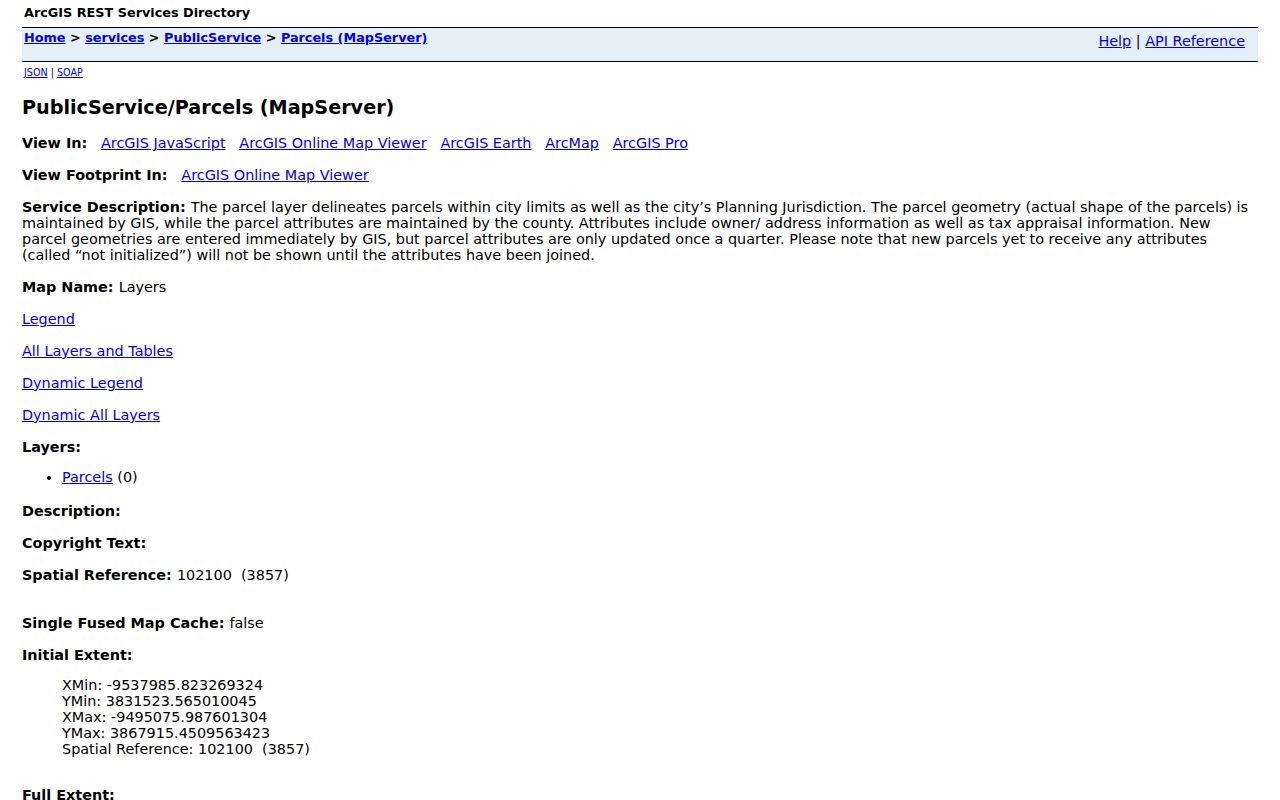
Those fields let a street search keep the site, tax contact, and deed reference separate instead of collapsing them into one claim about a resident.
Map Auburn Streets in Layers
The city map supports address, street, subdivision, and visual browsing. Its layers include parcels, address points, lots, subdivisions, annexations, city limits, zoning, floodplain, aerials, voting wards, polling places, school zones, police beats, fire zones, apartments, and mobile-home parks. A mapped address can also carry one of several authorities, including Auburn University, City of Auburn, City of Opelika, Lee County, a private authority, or the State of Alabama. The Auburn map legend shows how these layers are organized.
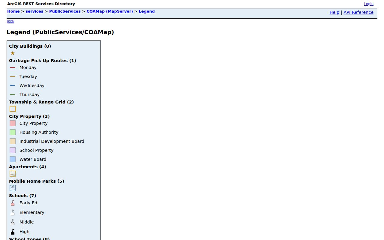
That variety explains why a point returned by the locator is not automatically a home. Point classes include residential and commercial units, but also temporary sites, utility points, mile markers, and emergency phones. Auburn's Address Locator accepts either “Street or Intersection” or a full address of up to 150 characters. Candidate results can include a match score, address type, number, directions, street type, unit, city, county, state, ZIP, and ZIP+4. A strong match confirms the standardized place, not the identity of anyone associated with it.
For a county-side comparison, the Lee County Public GIS provides parcel and appraisal context with advertised 2024 and 2020 aerial groups.

Using both views is useful when municipal layers and county tax attributes reflect different update cycles.
Auburn Records Keyed by Street
No official office holds a complete Auburn street directory. The practical directory is a set of address-keyed records with clear limits.
| Address source | Custodian | Useful evidence | Access route |
|---|---|---|---|
| Property and tax roll | Lee County Revenue Commissioner | Owner, parcel, appraisal, tax context | Free Taxpayer Search & Pay; Auburn satellite or Opelika counter |
| City parcel map | City of Auburn GIS | Situs, mailing, deed refs, lot and city layers | Free map and REST services |
| Recorded deeds | Lee County Probate Recording Division | Parties, legal description, prior-record link | Office viewing station or mail copy |
| Active permits | City of Auburn | Building, development, and planning projects | Permit portal and map service |
| Voter information | Alabama Secretary of State | Individual status or lawfully released file fields | Exact-input verification or governed request |
The Revenue Commissioner property search is the county ownership starting point. The Auburn satellite at 1266 Mall Parkway handles local revenue services, while appraisal and mapping questions can be directed to the Opelika office at (334) 737-3652. The research did not establish the satellite's exact terminal functions, so specialized questions should go to county appraisal staff.
Carry Auburn Deeds to Probate
Lee County does not publish a public web grantor-grantee index in the researched sources. Instead, the Probate Recording Division offers public viewing stations at 215 South 9th Street in Opelika. Staff can help with a name search. A mail request should include the instrument book and page and the recording date. Copies cost $1 per page, with $3 added for certification.
The key local shortcut is simple: begin with Auburn's parcel field for deed book and page, then take that precise reference to the county station. A deed identifies the grantor, the party conveying an interest, and the grantee, the party receiving it. It also carries the legal description. Follow that description, not merely the street number, when tracing the same land.
Recording charges are distinct from copy charges. Lee County lists a $5 index fee plus $3 per page for an instrument covering no more than two indexed names in the relevant party pair. Extra names cost $1 each, and extra book and page references cost $3 each. A person requesting an existing copy should use the separate $1-per-page copy schedule. The Revenue Commissioner's tax-sale information page is another official street source.
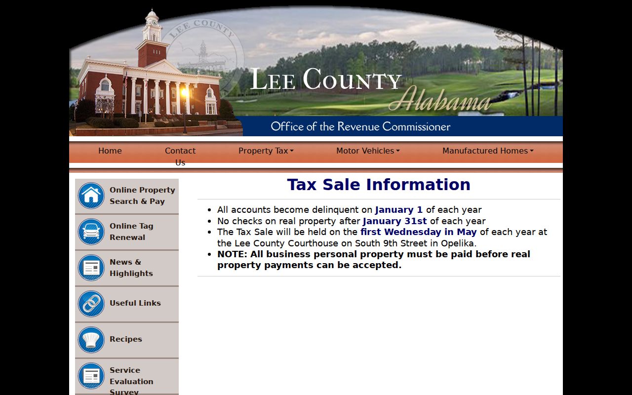
A tax-sale notice concerns a tax process and parcel, not a current household list. Terms can change by cycle, so the live notice should control.
Auburn Street Permits Need Context
Permits can place work at an address even when they cannot place a resident there. Auburn separates active permit data into Building, Development, and Planning layers. The service caps a query at 2,000 results, which makes a specific address or bounded map area more practical than an unfiltered citywide pull. The public-facing Auburn Permit Portal provides the project entry point.
A project applicant, contractor, or contact is evidence of a role in the work. It is not proof that the named person occupied the address.
The separate active permit map service exposes the three layer groups directly.
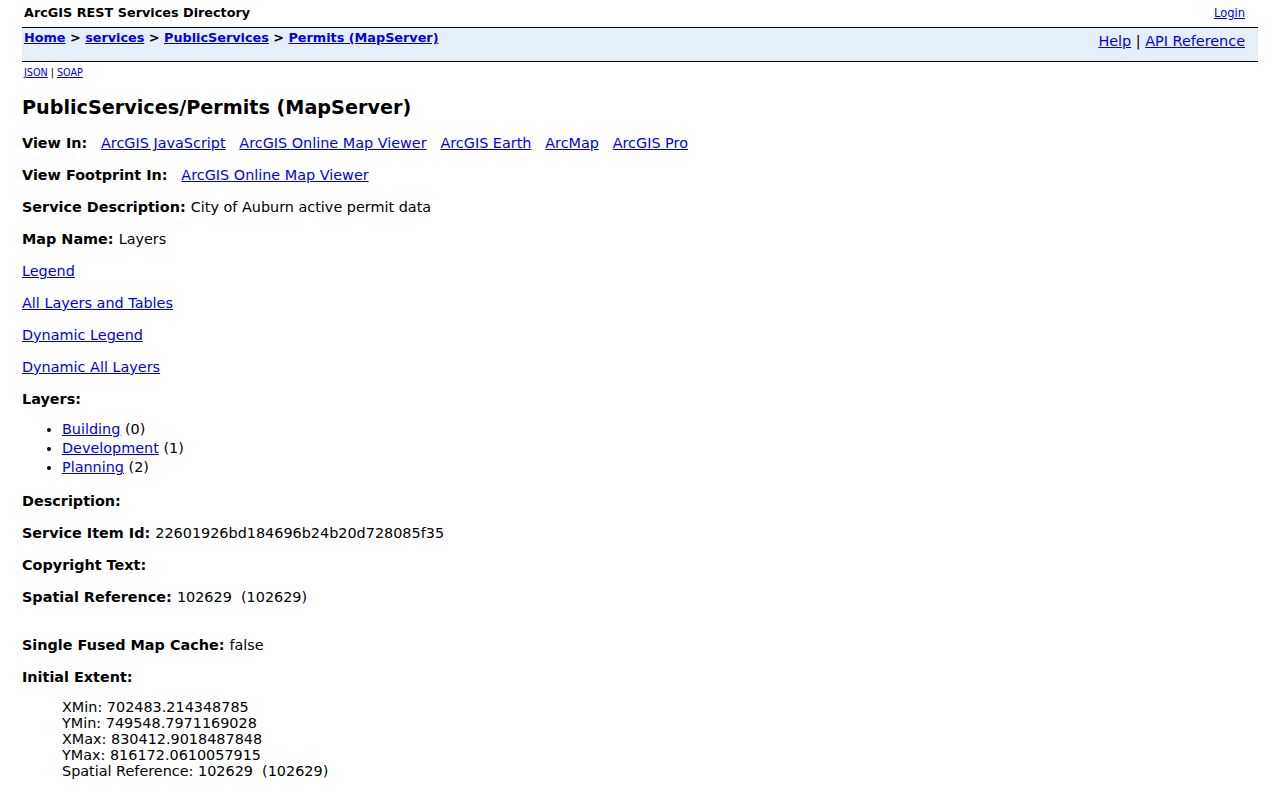
These layers add construction and development timing to a street-by-street search, but the archive start date was not published in the research.
Read Auburn Address Terms Correctly
Three address forms can appear in one search. Mixing them is a common source of false conclusions in an Auburn street directory.
- Situs address
- The physical location assigned to the parcel.
- Mailing address
- The destination for an owner's tax correspondence, which may be elsewhere.
- Parcel or PIN
- An assessor key used to identify land in tax and map systems.
- Plat
- A recorded map that lays out lots, boundaries, and related features.
- Legal description
- The recorded land description, often a subdivision and lot or metes-and-bounds description.
A different owner mailing address does not prove that a parcel is rented. A homestead code may support an owner-occupancy inference, but Lee County code meanings were not published in the reviewed material. Confirm the code with Appraisal before relying on it.
Auburn Streets Are Not Voter Rolls
Alabama's My Voter Page verifies one registrant through exact first name, last name, full date of birth, and a reCAPTCHA. It can return registration and polling information. It has no mode for browsing all voters on an Auburn road, so it cannot serve as a reverse street directory.
A formal voter-list request can select a county, city, or district and request fields such as name, status, residence address, mailing address when available, registration date, and election participation. Delivery and format options include paper, email, thumb drive, Excel, and tab-delimited data. The Secretary of State quotes the charge before payment.
The published schedule lists electronic records at one cent per voter under Ala. Code § 17-4-38, paper at $1 per page, and certification at $5. A requester can choose active, inactive, or both registration statuses and may specify a custom sort. Those options describe a governed file request. They do not turn the Auburn street directory into a live public voter map.
Current restriction. Changes effective June 1, 2026 restrict sale, publication, and commercial use of Alabama voter-list data outside specified election and political purposes. Protected officials and spouses may also have all public fields except their name omitted. Treat voter records as governed data, not an unrestricted Auburn address list.
Old Names Shift Auburn Streets
Street language can change while the land remains the same. In late nineteenth-century Auburn, Old Main became North College, and Church became North Gay. A search limited to the modern name can therefore miss older deeds, maps, notices, and directory entries.
Annexation creates another geographic break. Auburn's map distinguishes current city limits and annexation polygons, while the broader planning jurisdiction can include parcels beyond the incorporated city. An “Auburn” postal line does not prove municipal status. Compare the city-limit layer, the address authority, and the county parcel before deciding which office should hold a permit or civic record.
For past occupants rather than today's street context, the Auburn city directory collections include a verified 1923 volume. No complete local reverse-directory run was verified, so no unconfirmed criss-cross shelf should be promised.
Limits of an Auburn Street Directory
Parcel data identifies an owner or ownership entity, not every person living at an address. That gap is acute in Auburn's student-oriented multifamily buildings. Renters, family members, visitors, and many unit occupants do not appear in the tax roll. Utilities and delivery records are not an open resident source, and a permit contact is not an occupant.
Even official data has timing limits. County attributes in the city map update quarterly, deeds require a visit or targeted mail request, voter access follows state restrictions, and an address point may represent a nonresidential feature. Commercial compilation tools can also be stale or merge people with similar names. They should not override a current custodian record.
Lawful use. Auburn address records support family research, parcel questions, civic review, and personal safety. Never use an address trail to stalk, harass, threaten, or intimidate anyone. Verify sensitive conclusions with the office that keeps the record.